Pages

Showing posts with label public transport. Show all posts

Friday, January 20, 2012

New York City Transit Museum

NYC Subway Museum Historic Ads - Sept 2011 - 8

I always try to find time to visit the NY City Transit museum when I visit New York. One of the things I love are the historic advertisements that are in the old subway cars parked in the museum. This is a particularly fun one I think. The accompanying text says "Bet you do better in a hat!" and states that "84 out of 100 women prefer men who wear hats."

While at the museum I bought the book Helvetica and the New York Subway System: The True (Maybe) Story by Paul Shaw. I finished reading it before Christmas and it's really interesting - you'll never look at a NYC Subway sign the same way again! (Here's a link to a similar article he wrote on the internet - Paul Shaw, The (Mostly) True Story of Helvetica and the NY City Subway).

NYC Subway Museum Cars Sept 2011 - 7

And, one final photo of a mosaic from the Cortlandt Street IRT Subway Station (also in the Transit Museum collection). All my photos of the NYC Transit Museum on Flickr.

Tuesday, January 25, 2011

Bus Meister Game (beta) - Now online!


I have just finished the beta version of a game designed to help citizens understand public transport priority. The game is linked to a wiki that provides detailed information about measures to improve public transport. Once we are happy with the game we will place it on facebook and add social networking features so that players can discuss how to improve public transport in their own community.

I am looking for people to try out the game and wiki and to give me comments (also join the wiki as contributors!). The game is available now at: http://www.greencitystreets.com/busmeister

The wiki is available at: http://busmeister.wikispaces.com/

This page on the wiki provides instructions on how to play the game: http://busmeister.wikispaces.com/BMG_playing

Right now the game works, but we need to refine the values used to run the simulation and calculate the happiness and cost values. We will adjust these in the coming weeks and also add levels (so players advance to more difficult challenges) and other standard game features. We also will add more information to the pages. But, for now, the game works and we would love your feedback.

Finally, I hope to extend the approach to other modes of transport (biking, walking, street design) in the future.

Thanks for your help,

Tuesday, October 19, 2010

Bus Meister: Public Transport Priority Best Practices wiki

I have started developing the Public Transport Priority Best Practices wiki as part of my Bus Meister project. The wiki is being developed on wikispaces and here's a link to the page that describes how the Bus Meister game will calculate how long it takes passengers to board a public transport vehicle, and therefore how long the vehicle will need to stop at a station.

The page has links to the other pages too. Since it's a wiki please feel free to edit it ... it's quite easy really, but I may need to invite you, so just let me know if you want to help!

Enhanced by Zemanta

Wednesday, June 16, 2010

Rate My Street


Here's my street in Vienna rated on Rate My Street.

Just found a cool new website called Rate My Street that allows you to rate your street according to several criteria. It was developed in the United Kingdom, but since it uses Google Maps as a base you can rate any street anywhere.

Other great sites that can be used to rate streets and indicate problems that I discuss in my TRB Paper: Web 2.0 Applications for Improving Public Participation in Transport Planning include:

seeclickfix
walkscore.com
cyclopath.org - Twin Cities Minnesota Area

The ultimate goal of my Bus Meister project is to develop a similar application that helps city residents use an internet application to help identify, plan and support public transport priority measures that improve the attractiveness and efficiency of public transport routes they use every day. I'm struggling to finish a proposal right now ... more later!

Saturday, March 27, 2010

The Bus from Curitiba


My latest music video: "The Bus from Curitiba" probably needs some explanation, so here's a little bit about bus rapid transit and then the words with a couple comments.

Bus Rapid Transit and Public Transit Priority
Curitiba Brazil is famous for pioneering the development of Bus Rapid Transit (BRT). In the 1970s the city decided to build a very efficient bus-based public transport network instead of a relatively short section of metro line (which would have cost the same amount of money). The results have been nothing short of fantastic.

Curitiba's BRT system has been replicated throughout the world, although not to the extent that it deserves. Many cities are seduced by the thought of rail-based public transport preferring the sexiness of rail over the benefits of creating a more comprehensive public transport network.

Rail-based public transport is critical in large cities where there is sufficient demand, but I think it's better to build an attractive and efficient public transport network - based on buses - and then replace buses with higher capacity rail lines when necessary rather then building 'starter rail lines' and hoping to attract riders. It's the network that enables people to get 'from everywhere to everywhere' thus addressing the oft heard complaint that "I can't get there with public transport."


For more information on Curitiba see: the great Streetfilms Curitiba video showing the system in operation and describing how it works; Professor Robert Cervero's excellent book The Transit Metropolis (which also describes many other interesting examples of public transport throughout the world); and the wikipedia article Rede Integrada de Transporte.

BRT can be defined as the systematic application of public transport priority techniques. Zurich is a great example of another approach towards systematically applying public transport priority techniques; rather than building any large project Zurich incrementally added improvements that speed-up bus and tram service over the last thirty years thus creating a fast and efficient surface public transport system. You can read more about Zurich in Professor Cervero's book and in some of my publications and on my website improving public transport efficiency.

The Bus from Curitiba - Words and Comments

I visited Curitiba to ride the buses in 1997. The city was extremely pleasant and enjoyable. In addition to the buses I remember a fantastic passion fruit smoothie. Here are the words:
Fast and fun and clean and quickly,
The bus from Curitiba comes cruising,
And when she comes the people all say ahh ...
When she moves she's like a Samba that
Rides so smooth and sways so gentle
That when she passes each one she passes says ahh ...
Oh I would ride her so gladly,
If transport planning wern't done so badly,
Yes, I would ride her so gladly,
But each bus that we put in a plan,
Just gets replaced by a tram,
Fast and fun and clean and quickly,
The bus from Curitiba comes crusing
And when she passes I smile
But we don't BRT
Not in our city,
No we just don't BRT.

OK, I am not being totally fair. Planning isn't always done badly, but as I outline above, I think too often we ignore the bus option (of course capital and operating funding programs also enter into the picture, but that's for another song). And, of course, trams make sense in larger cities with strong demand, but gladly and badly is a pretty good rhyme don't you think?

Wednesday, March 24, 2010

Builder Bob on Westbahnstrasse


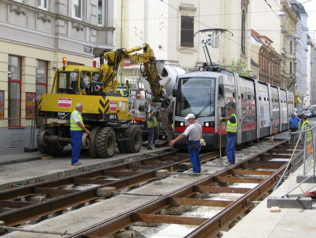
I just finished my series of website pages describing the Westbahnstrasse Tram Track Rehabilitation Project completed during the summer of 2009. The two new pages present aerial views of the work (from a neighbor who was also fascinated by the construction process) and photos of the workshop where the Wiener Linien prefabricate the track by cutting, bending and welding together sections of rail. The website pages include photos, descriptions and YouTube video links.

Now I can get started on this summer's Westbahnstrasse project: the Westbahnstrasse Chronicles! Stay tuned.

Wednesday, March 17, 2010

MIT Media Lab's Bill Mitchell Interviewed

Here's a great video interview of Bill Mitchell, the Smart Cities Director at MIT's Media Lab. They are developing ideas like the cars in the photo above, rethinking the entire concept of cars from technology to the transport systems in which they operate.

I was especially interested in his description of the 'future of mobility' where he talks about the need for sophisticated management algorithms helping to make more efficient use of existing resources (11:15 into the interview). This is exactly the idea behind the Bus Meister concept for using Web 2.0 applications to help provide priority for public transport.

Thursday, November 19, 2009

Web 2.0 and California High Speed Rail Planning

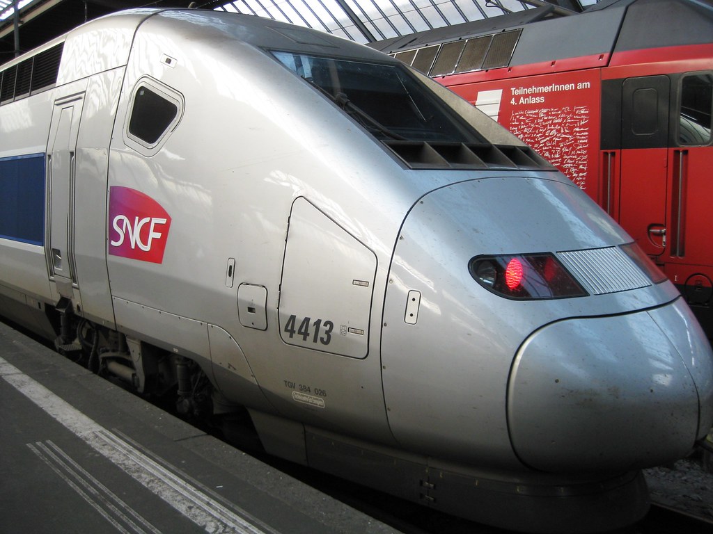
TGV at Zurich Hauptbahnhof - October 2009 - from my flickr photos.

As I mentioned in a previous post, I just finished revising my TRB paper on Web 2.0 applications for improving public participation in the transportation planning process (download here: web2transport). Yesterday I was talking to someone about some of the ideas in the paper and I remembered a story I wrote in 2005 as part of a proposal for completing the Regional Rail Plan for the San Francisco Bay Area.

The story was a speech given by one of the participants in the Regional Rail Plan planning process given 25-years after completion of the California High Speed rail system. I just re-read the story and I was surprised about how good it is and how relevant so many of the points it raises are today. So, here's the link to a pdf file. As they say, sit back, relax and enjoy the trip!

San Francisco Bay Area Regional Rail Plan - A vision (2005)

(By the way, although people I talked with on the inside said that this story was an important reason for selecting the consultant team, the consultants never asked me to help with the project and I'm not sure what ever happened to the plan itself.)

Tuesday, November 17, 2009

Web 2.0 applications to improve transport planning


Sunny day in Stockholm from my flickr photos.

I just posted the latest version of my US Transportation Research Board paper: Web 2.0 Applications for Improving Public Participation in Transport Planning on my website. I would love to get comments on the paper, so add one below or e-mail me directly.

I will be making a presentation on the paper at SPUR in San Francisco on January 7, 2010 and at the TRB Annual Meeting in Washington on Monday January 11. See my website for more details.

Wednesday, November 4, 2009

BART and Web 2.0


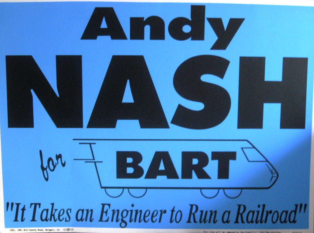
Sorry, I couldn't resist this photo from my
1992 campaign for BART Board Director.


I've been working on my TRB paper about the use of Web 2.0 applications in transportation and recently checked the Bay Area Rapid Transit (BART) website, and I have to say BART has done quite a good job.

First, the BART website provides all the information you need to use the system (schedule, station information, fares, etc.), so the basics are covered, but what I was interested in was how they are using Web 2.0 features.

I had read about BART's open policy for providing schedule data to outside developers and, there it was under schedules: a link to a page called BART developer resources describing how outside developers could use BART data to create applications. BART also has a page listing some of the applications developed by 3rd parties using this information.

I am a bit embarrassed to admit that I learned about BART's work in this area in a report by Patrick Gendre and Didier Danflous from CETE Mediterranee called "User participation in Public Transportation and Multimodal Information". The report is only available in French right now but I am working on translating it (in all my spare time!). Their report focuses on important issues with data availability. They believe that all public agencies need to recognize that Web 2.0 applications from outside the organization are coming (like it or not) and recommend that public agencies embrace this change.

Back to BART ... their website also enables people to submit photos to BART for use on their webpage, facebook and twitter pages. The photos are selected by BART, so it's not totally consistent with Web 2.0 openness, but a nice effort. Also it's refreshing to find a public transport operator that encourages people to take photos (safely!) rather than one that considers everyone taking photos to be terrorists.

All in all I think BART has done a good job with their webpage and think other public transport operators could learn a great deal from it.

I am still working on my Web 2.0 in Transport paper, so if you have any ideas or other websites for me to check out, add them in the comments!

Tuesday, October 27, 2009

Happy Birthday IRT Subway


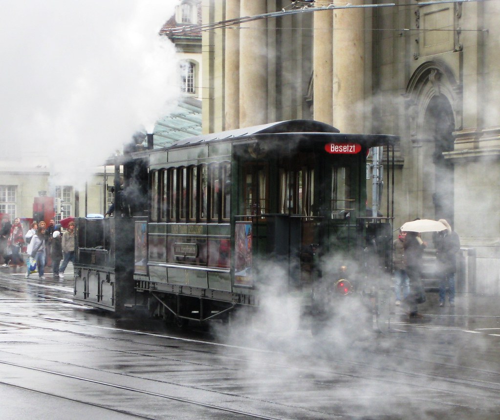
Steam tram in Bern (Switzerland) from my flickr photos (the subway replaced elevated steam trains in NY ... sorry I could not find my photos from the fantastic NY Transit Museum).


The IRT subway in New York began service on October 27, 1904! Here's a link to the NY Times article Our Subway Open, 150,000 Try It.

Monday, October 12, 2009

San Francisco Airport - Caltrain South


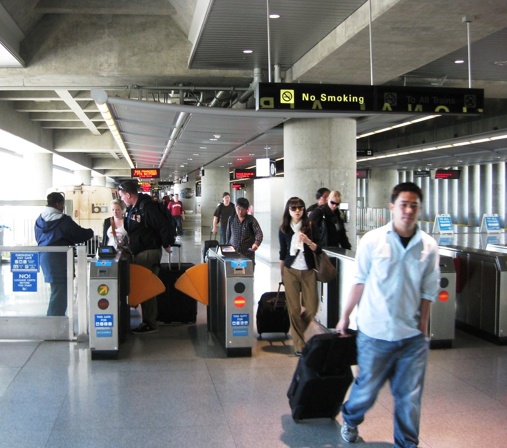
Continuing my USA travel adventure, from Boston I flew to San Francisco. I lived in San Francisco for about 20 years during which there were probably 20 years of controversy over extending BART to San Francisco Airport. Eventually a plan was approved and the extension was opened several years ago. While it works pretty well for trips to San Francisco and the East Bay (although it costs $8.10 now from downtown San Francisco - fairly close to the cost of a shared ride shuttle), the design is really awful for persons heading south on public transport (as predicted by public transport advocates during the planning process).

The first problem is ticketing - always a hassle in the San Francisco Bay Area! (See Paul Shigley's blog.) You need to buy a ticket for BART at the Airport Station ($2, I think the transfer to Caltrain was supposed to be free!). Then, after exiting BART in Millbrae, you need to buy another ticket for Caltrain at the Millbrae station.

If the Bay Area public transport operators cannot agree on a common ticketing system (see next paragraph), at least there could be a Caltrain ticket machine at the SFO BART station so that people could save time (and possibly not miss a train - I had this happen more than once! - waiting to buy a ticket at the Caltrain Millbrae station) by buying a ticket there. Or, thinking more creatively, the BART ticket machine could sell a special Caltrain Ticket that could be used on BART and had the Caltrain destination zone information printed on it - one ticket. There are probably lots of other creative solutions to this problem as well.

Back to the Bay Area's perennial problem of common public transport ticketing. It's really hard for anyone who has traveled outside the USA to understand the problem. Paper-based zone ticket systems have been used in European cities for probably 30-years. It's simply a question of political will and having a regional agency that is willing to force the different public transport operators to cooperate. The Bay Area's MTC seems to lack this political power, too bad.

It's important to understand that developing these common ticketing schemes is not easy in European cities either. Many European regions have used incentives such as major capital projects to encourage participation by reticent public transport operators (this was done in Zurich: the voters said no money for the new regional rail system improvements if ticketing and schedules were not coordinated). It seems that in the Bay Area the independent public transport operators have more clout with the federal government capital programming than the regional agency, so they ignore coordination.

The Bay Area is rolling out a new electronic stored value card system called TransLink to reduce the need for different tickets. TransLink has been under development for as long as I can remember - while bigger cities like London and NY have already implemented very successful electronic ticketing systems.


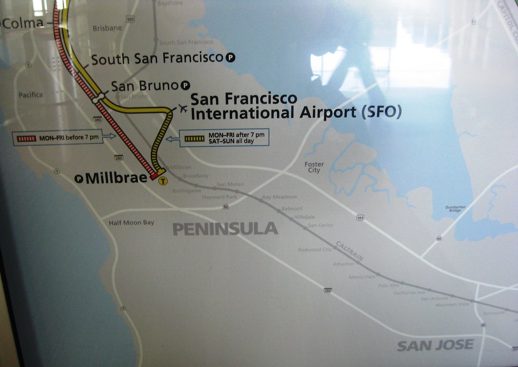
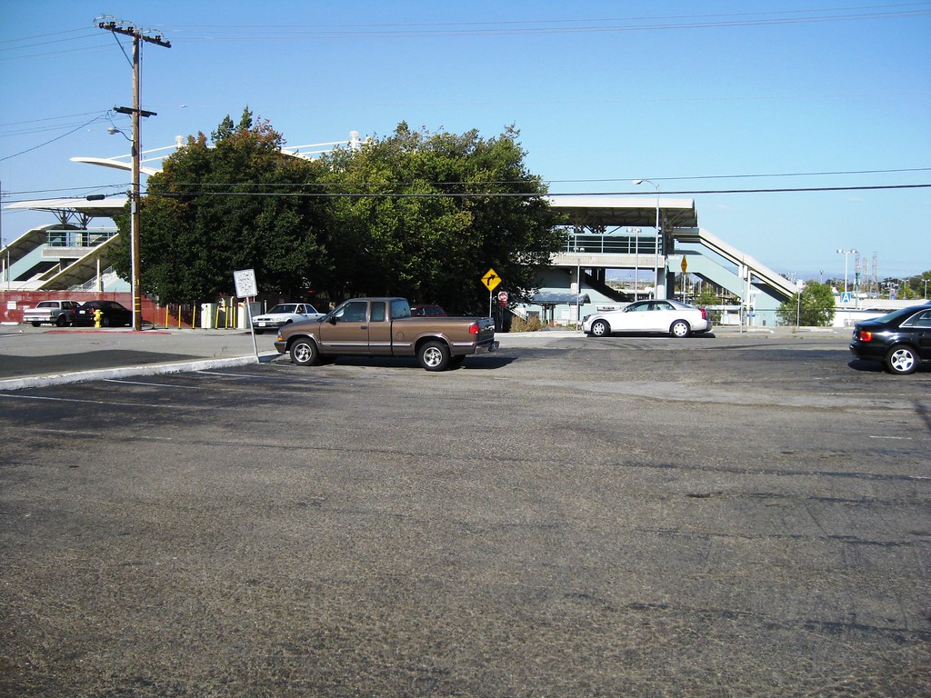
The second problem with heading south from San Francisco Airport on Caltrain is the linkage between the airport and Caltrain station. BART heads into the airport in a terminal station and then needs to reverse out of the station. Originally trains reversed out of the station south one stop to the Millbrae BART-Caltrain station throughout the day. Due to budget cuts (?), trains now only go north from the airport before 7 pm. Here's a bad photo of the BART map (too much light) showing the operating pattern.

This new operating pattern means that passengers wanting to transfer to Caltrain must take the train north one stop to San Bruno, then wait for a southbound BART train to take them to Millbrae. I arrived at the SFO BART station just as a northbound train pulled into the station. It took a full half hour to make the trip to Millbrae via this route (and it would have been longer if I had had to wait for BART at the SFO station). It's probably faster to walk to the Millbrae station.


Caltrain really should re-implement the shuttle bus system it had before BART was built, this was much more convenient and reliable. This is especially true because the shuttle could be coordinated with the Caltrain schedule. During the day Caltrain runs a combination of express and local trains. It's possible for you to reach the Millbrae station right after your local train has left and then need to wait for an hour for the next train (this becomes extremely frustrating given the time wasted on the convoluted BART trip to Millbrae from SFO).

On my trip I could have taken a local or express train. I missed the local train by about 2 minutes. (Incredibly the local Caltrain trains are scheduled every hour and the BART trains have a regular 15-minute headway ... this means that every connection is missed by about 2 minutes!) Since I could take the express train too, I only needed to wait about a half hour at the desolate Millbrae station.

There's probably a good book on transport planning practice to be written on the BART to San Francisco Airport. There are so many lessons that could be learned. I think that the most interesting story is how little power transport planners had in the process of planning the project. The engineering is fine, but the main questions of how the project relates to the overall public transport network on the Peninsula and in the region, were answered in an ugly political process. The results are a badly working system and a myriad of lost opportunities.

Thursday, September 24, 2009

Improv Everywhere: NY Subway Yearbook Photos


Another great project from NY's Improv Everywhere. Why can't public transit always be this much fun?

Tuesday, September 15, 2009

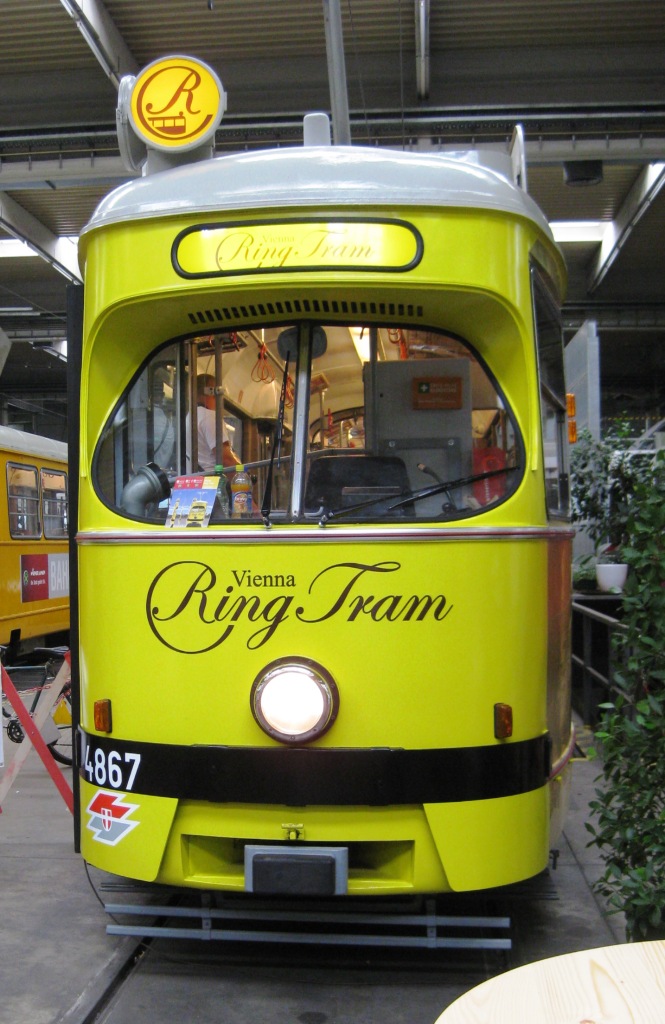
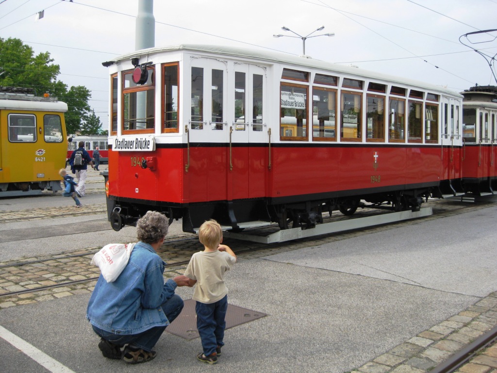
Vienna Tram Day 2009

Wiener Linien Tram Day 12sept09 - 10

On Saturday the Wiener Linien (Vienna Lines), the city's public transport operator held its annual open house at the main workshops. It was a nice day and a great party. Here are a few photos.


Inside the railway vehicle maintenance area. The Wiener Linien had set up displays of interesting information (how the new real time passenger information system works, etc) with various types of public transport vehicles interspersed between the displays.


The new Ring Tram was on display. The tram lines that used to run on the Ring (#1 and #2) were recently re-routed so they only go on part of the Ring. The Ring tram is designed for tourists and has information in several languages available on headphones. It has a special (higher) fare, but it's well worth riding.


What is it about kids (of all ages) and trams?

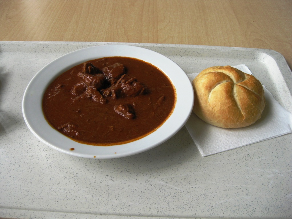
No Austrian event would be complete without food and drink. Below is my Goulash lunch at the employee cafeteria ... not as good as mine, but quite good.


Back to work ... here's a photo of several rail vehicles being maintained. On the left is one of the old trams, on the right (up in the air) is one of the old subway (U-Bahn) cars.


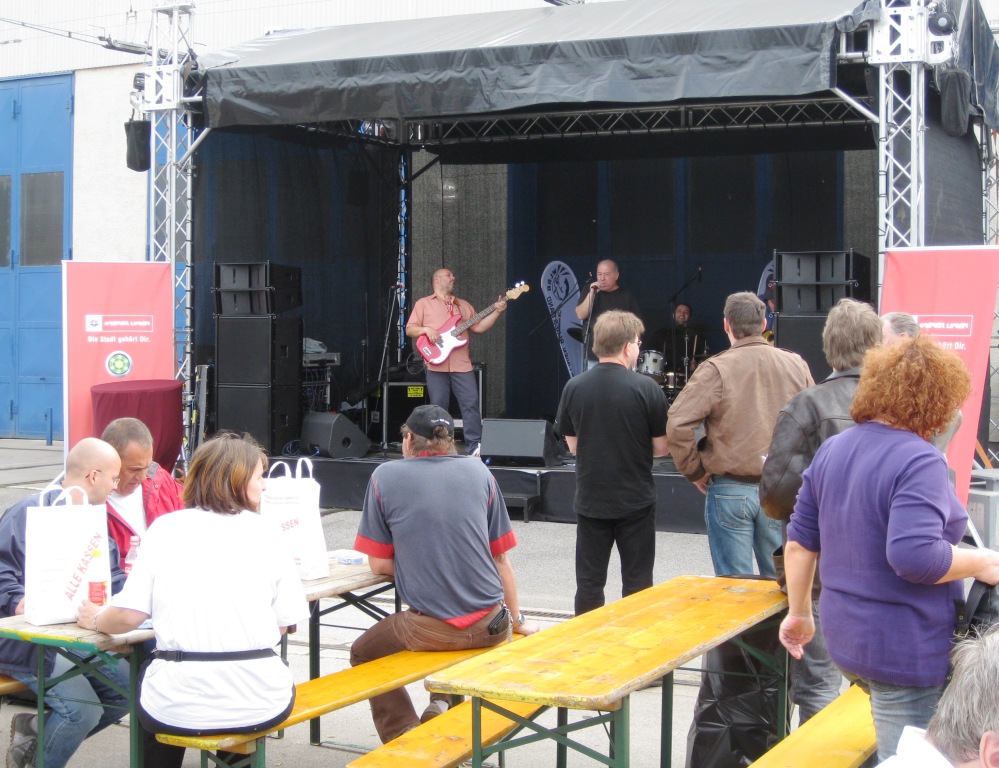
I don't know how many public transport operators have their own Blues Band, but the Wiener Linien does: the Wiener Linien Blues Band. They were playing Mustang Sally, I don't know why they didn't play Tramway Charlie ... but maybe next year!

Monday, September 7, 2009

Westbahnstrasse Tram Track Reconstruction


As I mentioned in previous posts the Wiener Linien has been rebuilding the tram tracks in our neighborhood this past month. I am putting lots of the photos on my website and also several movies. I now have five movies of the construction process on YouTube, above is one of them. I will write another post when the website is finished.

Wednesday, September 2, 2009

Otto Wagner and Vienna Transport - 1


A colleague from San Francisco was in town last week and, as usual, visitors call attention to the things you don't always notice as you go about your everyday business. I have been following his blog (Jarrett Walker, www.humantransit.org) and added a couple comments and then thought, well one of these comments is something I've wanted to write about myself for a while, so here's a first installment on Otto Wagner and his influence on Vienna transportation planning.


Otto Wagner is a fascinating example of an architect who also did some great urban civil engineering. There is a nice exhibition of his work at the Wien Museum's Otto Wagner Pavilion located in the Karlsplatz U-Bahn entrance (designed by Wagner). The museum is very small but manages to present a good summary of Wagner's work.

Also don't miss his Hof Pavilion
(German website, nice photos) a private station designed for the Kaiser at Schönbrunn (the Kaiser's summer palace). The Hof Pavilion is adjacent to the Hietzing U-4 station (one station beyond the Schönbrunn station). Right now it's only open on Sunday mornings (see German website for times) but well worth the visit for fans.

Of course you can still see Wagner's influence in the design of many stations on the U-4 and U-6 lines. Both these lines were operated with steam engines in Wagner's day (he developed the conceptual plan for these lines as well as designing many of the stations and infrastructure). The photo on the right is of his famous bridge on the U-6 line over the Vienna River at the Gürtel. The photo is taken from the U-4/U-6 Längenfeldgasse Station.


Wagner's lines were later converted to electric trains then into Vienna's U-Bahn network, but many stations were maintained and have been renovated. The photo on the right is a detail of Wagner's bridge on the U-6 line. All photos are on my flickr photos of Vienna public transport, where there are many more photos of Otto Wagner stations and bridges.

Vienna has done a wonderful job restoring many stations designed by Wagner. A couple years ago they rehabilitated the Gumpendorferstrasse Station (U-6) - shown at the top of this post. They did a great job integrating new features (e.g. elevator) and new floor tiling (rubber non slip) that matched the old style. It is great that Vienna does not eliminate history from their transportation infrastructure in the name of efficiency or current fashion. As places like NY Grand Central Terminal show, old pedestrian flow designs often work much better and the buildings are much more gratifying as many modern designs.

Monday, August 31, 2009

Westbahnstrasse Tram Track Reconstruction Pages

I've been working on my website pages that illustrate the reconstruction of the tram tracks on Westbahnstrasse (Vienna) near our house. The project is almost over and has been fascinating to watch.

Here's my Westbahnstrasse Tram Track Reconstruction Homepage with links to my pages on Construction signs and artistic photos.

Let me know what you think!

Sunday, August 23, 2009

Swiss Travel System Video Contest - Bad News For Andy


Unfortunately my video entry for the Swiss Travel System Casting competition was not selected. Since I won't be heading to Switzerland, maybe somewhere else would be nice? Check out the video.

By the way, the Swiss Travel System Casting competition was lots of fun and congratulations to the winners! You'll really enjoy Switzerland and its fantastic travel system.

Best Alternative Subway System Maps


I just read about Treehugger's Best Alternative Subway System Maps slide show on The Economist's Gulliver travel blog. The slideshow is fantastic, a must for all public transport lovers!

Above is a photo of an advertisement for Vienna's alternative radio station FM4 in the form of a Vienna Subway map.